Transform Your LiDAR Data into Actionable Insights on Tree Counts, Heights, and Locations
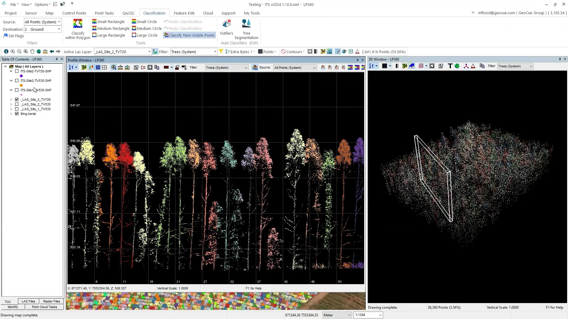
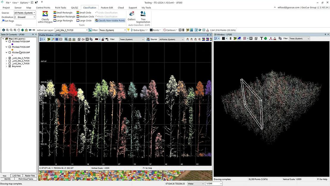
LP360 Drone's Individual Tree Segmentation (ITS) tool is a new addition to the Business Intelligence Add-on, designed specifically for forestry management and environmental monitoring. Leveraging advanced LiDAR data analysis, this tool can identify and catalog tree counts, locations, heights, and tree crowns across forested landscapes.
This video showcases the innovative ITS Tool and includes a demonstration in LP360 Drone. This new feature excels at determining tree counts, locations, heights, and tree crowns from LiDAR data, although it does not specify tree species. The tool efficiently creates a new LAS layer for visualizing individual trees and generates a point feature layer (in .shp or .csv format) detailing the location and height of each tree crown. Watch the video below:
Individual Tree Segmentation
Optimized for managed forests such as orchards and plantations, the Individual Tree Segmentation tool has the flexibility to support a broad range of applications, making it a versatile asset for various types of forestry projects. A prerequisite for utilizing this tool effectively is creating a ground classification of the data, ensuring accurate tree segmentation. Furthermore, the extracted data is compatible with any GIS workflow, making it a flexible and powerful addition to forestry and land management projects.
Whether managing a plantation, conducting environmental research, or planning land use, the LP360 Drone's Individual Tree Segmentation tool offers an innovative solution to transform LiDAR data into actionable forestry insights. To learn more about this innovative new tree counting feature in LP360, schedule a time to meet with one of our software experts.