NOW AVAILABLE ON
YOUTUBE AND MDTV
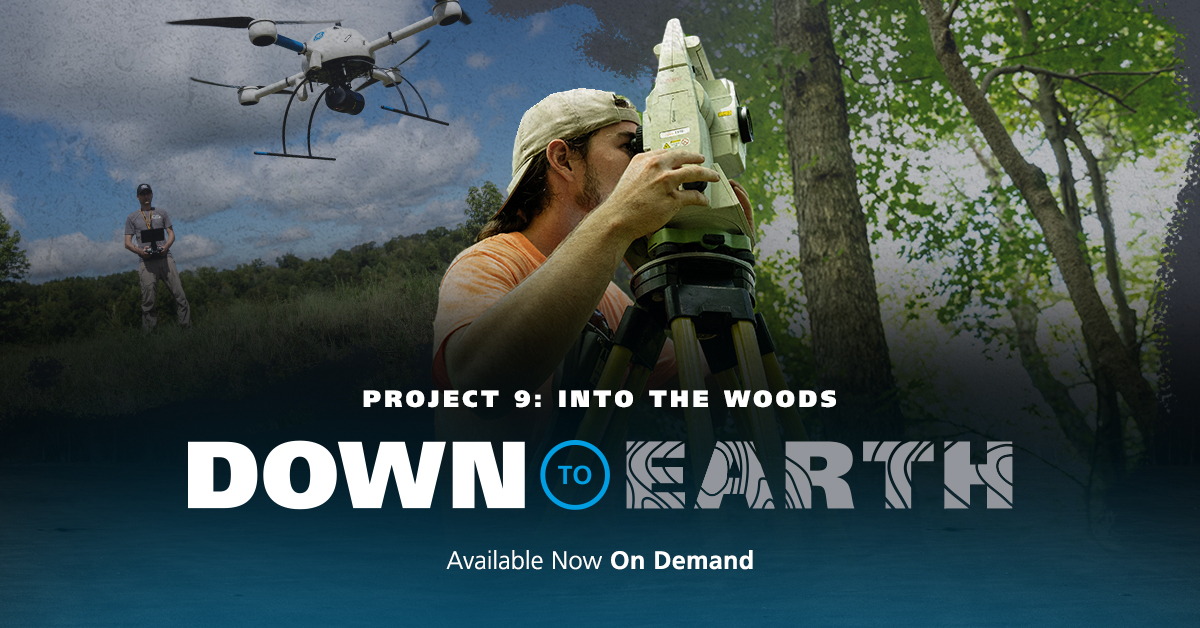
DOWN TO EARTH PROJECT 9: INTO THE WOODS
Down to Earth, a surveying reality series shows how real surveyors collect data and turn it into real deliverables, despite challenging conditions, rugged terrain and lurking dangers.
In these 4 informative episodes, Allen Geomatics, a land surveying and consulting firm located in Advance, NC, utilizes a 3 man crew to collect their ground shots and survey the site while Robert Chrismon, PLS, takes a different approach high in the sky with Drone LiDAR. In this 1st episode of Down to Earth, we meet Jeff Allen, owner of Allen Geomatics P.C., who is curious to see if drone surveying methods can enhance his practice.
That’s why he invited Robert Chrismon, PLS, a former surveying co-worker and early adopter of drone surveying equipment, to one of Allen Geomatics’ design surveys for a development project. Together they’ll compare the traditional methods on the ground and Robert’s drone LiDAR system to create a digital map with 1 foot contours as a deliverable.
Watch Episode 1 Below:
Episode 2 sees the duo step into the woods to join the Allen Geomatics 3-man crew as they use a Total Station to collect their shots on the ground. Each surveying method faces challenges in the form of thick vegetation, changes in elevation, river embankments and more. “Looking at the distances between the shots taken by the Total Station, it leaves a lot of little undulations and information left to be located,” Chrismon noted in the field. “That’s what we pick up with the LiDAR.”
Watch Episode 2 Below:
The Allen Geomatics office is where Episode 3 begins, as Robert and Jeff compare the results and assess the differences between the traditional and drone surveying data. Both the conventional and drone data are able to provide the final deliverables. “It’s easy to pick out the features that we surveyed in the point cloud,” said Allen. “You can see a clear definition of the road and the crown that we talked about from my data. This has really helped me realize how close my small company is to using Lidar to help us with our topos.”
Watch Episode 3 Below:
The series concludes with the fourth episode set in a local restaurant, where Jeff and Robert review the project, workflow, and discuss the changing landscape of surveying technology, all while enjoying a cold beverage.
Watch Episode 4 Below:
If you would like to learn more about adding drone surveying into your workflow, CLICK HERE to speak with one of our helpful representatives.