The journal Bauingenieur published an article on the drone surveying work being completed by Schulte Surveying from their Schmallenberg office in North Rhine-Westphalia.
The journal Bauingenieur offers essays on the theory and practice of structural engineering, mechanics, geotechnics and construction operations and construction management.
Measurements from the air
Drone Surveying Equipment has made it possible to quickly survey industrial areas because the data recorded can easily be transferred to CAD software which can then be further processed.
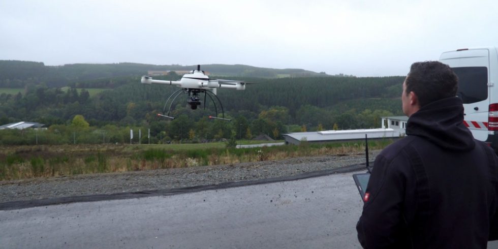
The Schulte surveying office from Schmallenberg in North Rhine-Westphalia was entrusted with the task of surveying a large industrial area. Because road construction had already been completed in the area, one challenge was that data collection would be carried out on an active work site.
The office found a practical and convenient solution for this project by using a Microdrones mdMapper1000PPK, a fully integrated system that made it possible to use the data collected in CAD processing for all future projects. The drone surveying equipment allows the engineers to determine millions of datapoints.
“Both partners assured us of comprehensive support, which was very important to us,” says Markus Schulte, Managing Director of the Schulte surveying office, describing his decision. For Schulte, it was important that solutions for the challenges were found and that assistance was provided with subsequent surveying tasks.
Flying over the industrial area during operation was the greatest challenge. “It leaves no room for error,” explains Samuel Flick, Central European Sales Manager at Microdrones.
For this reason, the customer involved everyone in the construction project. The drone had to photograph and document large areas with relatively little vegetation and then the iTWO Civil, RIB software solution was used to create digital terrain models from the millions of data points or use data directly from the point cloud. Compared to traditional surveying, using drone surveying equipment was much more efficient.
“We need immensely high data quality and technology that is not only high-resolution, but also interacts optimally with one another," says Schulte, describing his approach. “Two things are fundamentally important: the data accuracy and the reliability of the recordings. The areas we need to measure are often huge and our time frame is limited so this means that we need complete information, which will allow us to process further in the office with little effort in order to create street plans, sewer plans, and all other necessary planning data."
Markus Schulte, Managing Director of the Schulte surveying officeWe need immensely high data quality and technology that is not only high-resolution, but also interacts optimally with one another.
Achieved High Image Quality
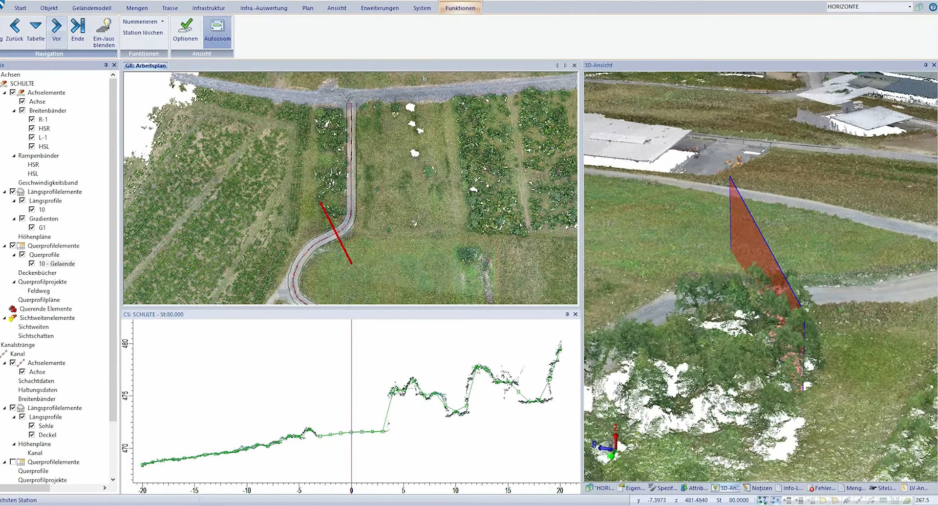
In order to achieve high image quality, it is important that the CAD system knows how to handle large amounts of data. Point clouds with 500 million points and more are now the standard. However, point clouds are "only" pixel data. The further you zoom into the point cloud, the more difficult it is to grasp the situation.
“For a particularly high level of detail, so that it is possible to digitize the smallest paving stones with practically millimeter precision, RIB recommended using orthophotos,” explains Andreas Dieterle, Product Manager Sales for Infrastructure at RIB. “This means that the details are clear even at extreme zooms and it is possible to determine the exact 3D coordinates from the point cloud.”
The possibility of storing point clouds centrally within the software solution, thus saving storage space, allows the data to be used for multiple, cross-project use. With the software, digital terrain models can not only be generated quickly and easily from the point clouds, but longitudinal and transverse profiles along an axis can also be obtained directly.
In the resulting cross profiles, the section through the point cloud is also shown so that the quality can be checked and the cross profile can be adjusted if necessary. Post-processing within the software also saves additional recordings in the field because all relevant data has already been recorded.
Drone Surveying in Practice
Schulte carried out several flights with the Microdrones integrated system. They then generate the digital terrain model in the software relatively quickly. The point cloud is able to represent every type of terrain change, working in terms of color as well as dimensions. With data from several flights, it has made it possible to make comparisons with the terrain from each phase of construction and thus to show changes very precisely.
For more information on using drone surveying equipment from Microdrones, CLICK HERE to contact one of our professional representatives.