If you've watched Down to Earth, Cougar Country, then you might be interested to take an interactive look at the point cloud created from data collected at the Bermuda Lakes construction site. This data was collected using the mdLiDAR1000 aaS flying at 4 meters per second and an altitude of 50 meters. Click the image below to go to the point cloud viewer.
“Down to Earth” is the surveying reality series from Microdrones that shows how real surveyors collect data and turn it into real deliverables, despite challenging conditions, rugged terrain and possible dangers.
In the Cougar Country episodes of Down to Earth, we join the Southwestern Florida Cougar Companies as they use Drone LiDAR Surveying Equipment to provide more detailed topographic surveys. However, they have to contend with the unpredictable Florida weather as they try to collect data, confirm fill quantities, and stay on budget.
Watch as the Cougar Companies fly ahead of their competition and use drone LiDAR technology to provide a more thorough picture of sites both pre and post-construction.
Drone LiDAR
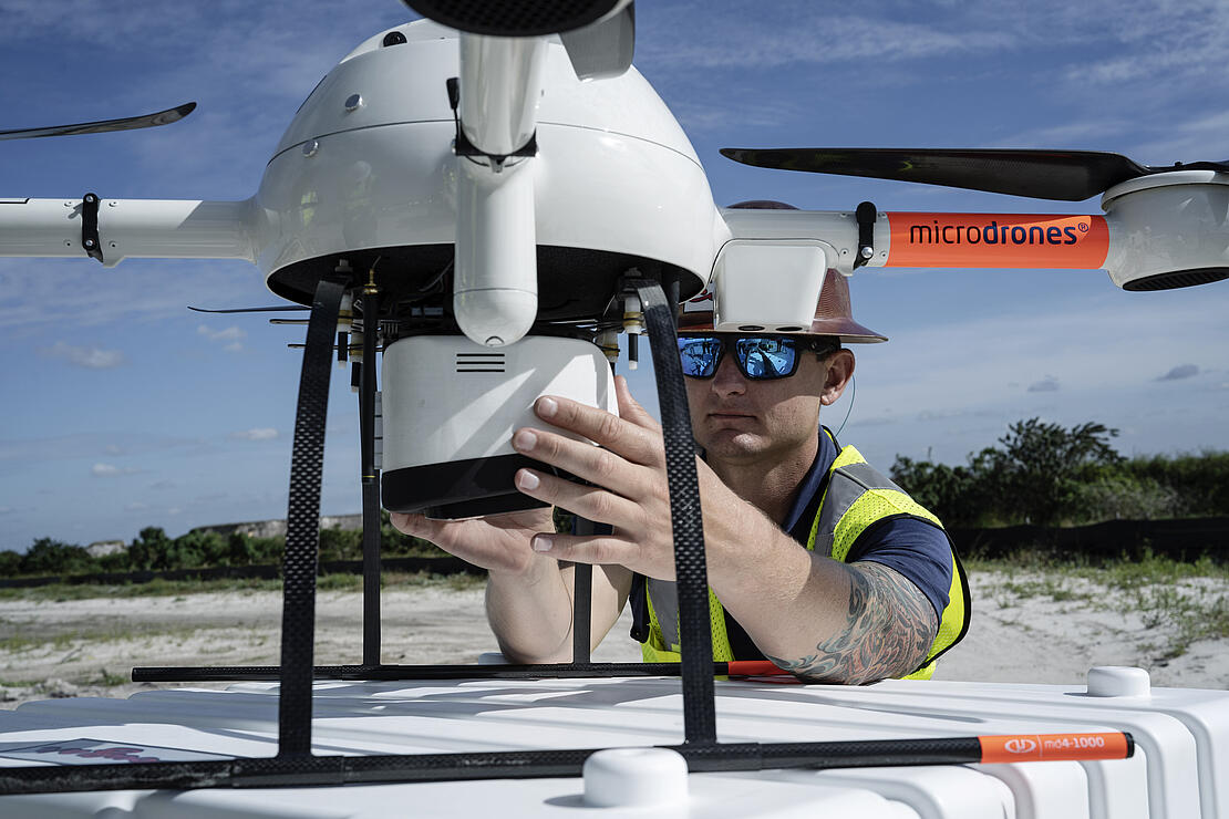
The mdLiDAR1000 aaS gives Cougar Companies an advantage during bid negotiations, helping them win more projects. Adam Murphree, the Director of Technology for Cougar Companies, is the chief pilot of the mdLiDAR1000HR and uses the drone technology to create existing condition topos with millions of shots rather than just a few hundred. The data is also being used to confirm import fill quantities, giving Cougar an advantage on pricing.
“Thereʼs been multiple occasions in the early stages of utilizing drone surveying technology from Microdrones, where we have prevailed and been successful by having the ability to provide accurate data to both the owners and engineers eliminating any questions on the big ticket items,” Cougar Companies President, Andrew Schmitt said.
LiDAR also saves time. When working with photogrammetry, processing all the data collected during the flight can take hours, especially if they’re taking images of a larger site.
“LiDAR gives you the ability to get through trees and still get data from the surface, and it does it in a fraction of the photogrammetry processing time,” Murphree said. “That’s huge. A dataset that might take half a day to process with photogrammetry is done in 10 to 15 minutes with LiDAR.”
Andrew Schmitt, Cougar Companies PresidentOn this project, using the drone LiDAR, we found in excess of over a 40% discrepancy compared to other bidders based on the design drawings we were given.
Bermuda Lakes Point Cloud
The data for the point cloud was captured over the Bermuda Lakes construction site and was collected by the mdLiDAR1000 aaS over 4 flights. The drone flew at an altitude of 50 meters and a speed of 4 meters per second. The duration of each flight was approximately 14-17 minutes completed in 28 legs with 60% overlap.
To create the point cloud, the data from Bermuda Lakes was first processed with mdInfinity Trajectory Processing and Georeferencing modules. Then further processing in mdInfinity was conducted which allowed for strip adjustments, removing outliers and ground classification.
Using the point cloud created, Murphree will be able to create a surface area with just the ground points and compare the results to the original design to determine exactly how much material is owed to the job site.
“Since Cougar Companies was able to introduce the mdLiDAR1000 into our workflow,” explains Schmitt, “we have been able to work from a much more formative and accurate stand point. On this project, using the drone LiDAR, we found in excess of over a 40% discrepancy compared to other bidders based on the design drawings we were given. What we were able to do is sit down with that developer and owner and use this data to help them understand actual projects costs and help them eliminate change orders. The data certainly puts us ahead of the competition.”
For more information on putting drone LiDAR to work for you, CLICK HERE to speak with one of our friendly representatives.