
Where is the Microdrones World Tour Making a Stop?
The team at Microdrones has been on the road and busy attending conferences, demonstrations, and roadshows featuring the benefits and advantages of using drone surveying equipment and software this past month. Learn where we’ve been and what’s new for the 2021 Microdrones World Tour.
GéoQc2021
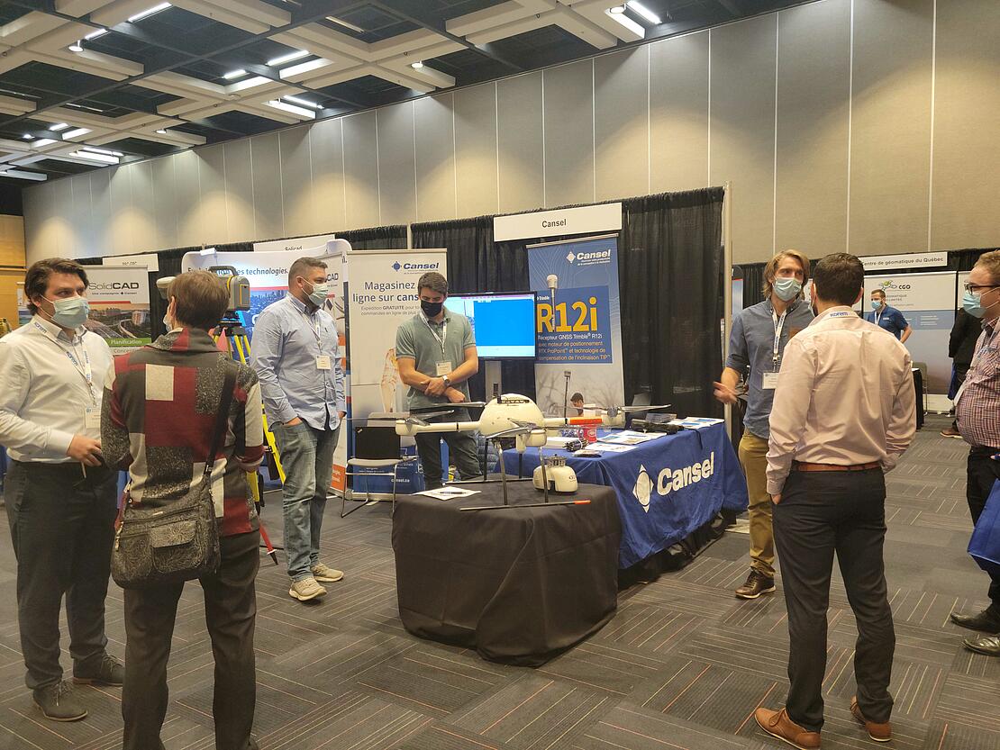
October 21st and 22nd the World Tour landed in Québec City, Canada with our Canadian distributor Cansel for GéoQc2021. Organized by the Canadian Association of Geomatics - Champlain Section and the Order of Land Surveyors, GéoQc2021 brought together the geomatics community at the Quebec congress center, enabling meetings and exchanges between several governmental, educational, and private organizations.
Sebastian Long, the Canadian Sales Manager for Microdrones, joined David Laflamme, Segment Manager, Aerial and Terrestrial Imaging for Cansel, along with other team members from the distributor at the event. “It was the perfect moment for Microdrones and Cansel to present our systems and display the mdLiDAR1000HR. We were also able to answer several questions concerning operations with drones in different scenarios,” Long explained.
Some of the current themes covered at GéoQC2021 included Quebec land registry reform, land protection plans against flooding, disaster risk management, public health, hydrospace, and artificial intelligence.
“We also took some time to attend several conferences,” said Long, “including the one on the Quebec land protection plan against floods and the measures put in place by the government to improve the safety of people and the protection of property. Our drone surveying equipment can play a key role in this plan by providing very high-quality tools for mapping the flood-prone areas safely out of harm's way. It was great to connect with various attendees, current and future Microdrones clients with our great Canadian partner Cansel.”
The Energy Drone & Robotics Summit
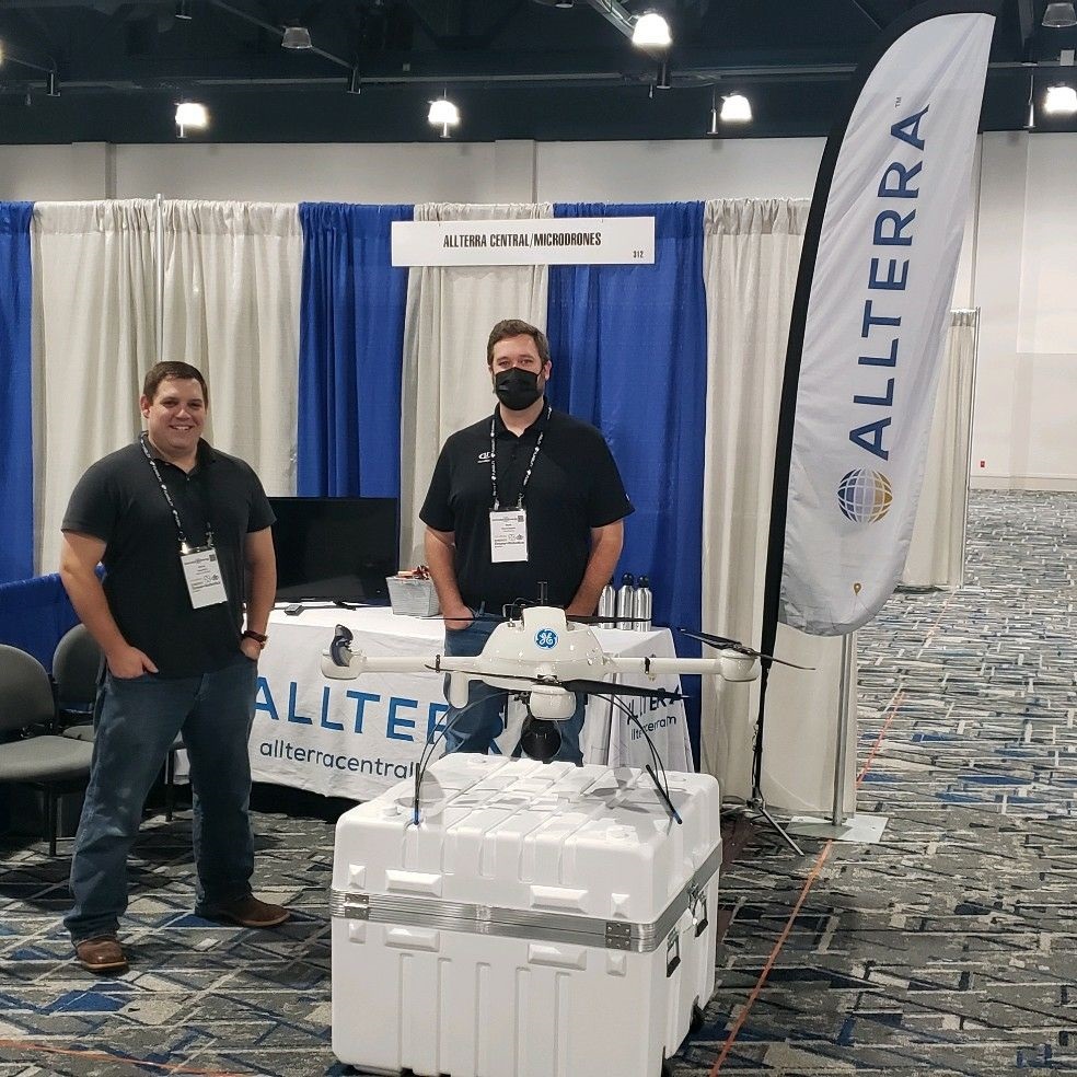
Up next, the Microdrones World Tour touched down in Houston, Texas for the Energy Drone & Robotics Summit, October 25-27. Representing Microdrones were Matt Rosenbalm, the Eastern US sales representative, and Chuck Dorgan, the Director of Sales for North America. They were joined by Christopher Mauldin, the Technology Sales Manager, and Kristopher Fairley, the Lead Support-Advanced Technologies & Trimble Certified Trainer at AllTerra Central, Inc.
This is the largest global summit of the Energy Drone & Robotics Coalition, which hosts the only event series exclusively focused on the business and technology of unmanned systems, automation, and data/AI in energy operations. At the event, Matt Rosenbalm gave a presentation on “How to Streamline Your Corridor Mapping Workflow.”
“There was a lot of buzz about our new GE industrial drone line at the event,” said Rosenbalm. “It was great to partner with Allterra Central and work this event together. Our fully integrated Lidar and Photogrammetry systems are ideal for industrial applications in the energy sector.”
The Kuker-Rankin “Precision Takes Flight” Road Show
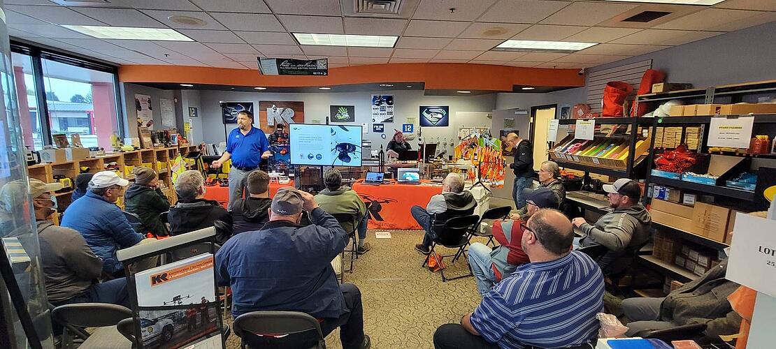
Aaron Beach, the Western Regional Sales Manager for Microdrones, added some miles to his odometer as he joined the Kuker-Rankin “Precision Takes Flight” Roadshow throughout the Western US, October 21st through November 9th. The roadshow made stops in Las Vegas NV, St. George UT, Salt Lake City UT, Boise ID, Portland OR, Tacoma WA, Spokane WA, and Seattle WA, where attendees had the opportunity to observe drones in-flight, see how data is safely and rapidly collected, and see how mdInfinity software can process aerial data.
At each stop, Aaron and the KR team presented an in-classroom workshop showcasing the Microdrones technology, including a high-level overview and how drone surveying equipment is changing the way the GIS industry is capturing data. After the workshop, the team headed outdoors to demonstrate the full workflow of plan, fly, process, and visualize from the aircraft and software for processing data.
“It's been an awesome three weeks on the road with Kuker-Ranken Inc. for the Precision Takes Flight UAS roadshow,” said Beach. “Douglas Spotted Eagle and the KR team do a fantastic job of educating both new and experienced UAS professionals. I really enjoyed meeting so many new faces from the surveying world and introducing them to the benefits of LiDAR equipped drones from Microdrones.”
Stay tuned for more Microdrones World Tour stops and events coming soon. You can also talk with our sales team to learn more about drone surveying equipment and software today.