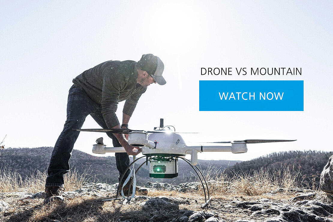
It's drone vs. mountain in this 3-minute drone surveying case study. Watch the video and register to view the LiDAR point cloud.
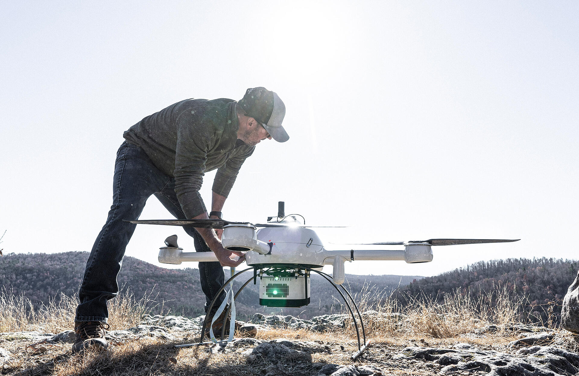
Engineering and surveying firm Crafton Tull was tasked with mapping an area in the unforgiving Ozark Mountains. Their job is to collect geospatial data on 150 acres of the cliff-filled region of Big Creek so that their engineers can design a road through the heart of the mountainous terrain. To accomplish this task, they're using drone LiDAR to efficiently survey the project and stay out of harm's way. See how they set up their mission, collect data, and find out if they're able to overcome the challenges on the mountain in this 3-minute case study.
The Big Creek River cuts through the Ozark Mountains, undecided if it’s a creek or a river. What is known is that this terrain is difficult, so much so that even Bigfoot might wander elsewhere.
The mission is to survey these 150 acres to design a new road. Crafton Tull realized that sending people into this terrain would be timely and expensive. Instead, they used drone LiDAR.
Could this small, unassuming drone be powerful enough to go toe to toe with the mountains?
The Crafton Tull team felt confident in their initial setup and deployment. It was going to require quite a jump to scale the mountain from top to bottom. So, the battle was set—drone vs. mountain!
Round one went to the mountain, as battery capacity to cover this massive area and height change ran out. The drone isn’t easy to defeat! With new information from Randy, the land manager, the crew discovered they needed to concentrate on the valley to get a better vantage point. Will the drone rise up? Or will the mountain remain king?
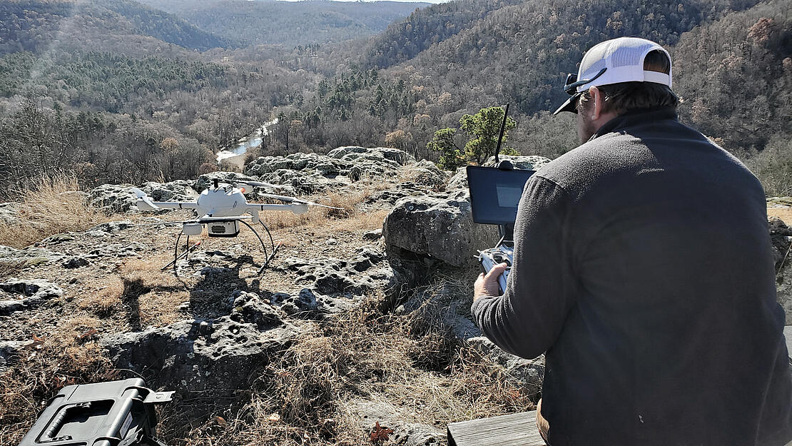
The local intel from Randy helped give the drone the edge with some relocating. The Crafton Tull team used learnings from day one to plan better for day two. The group made it through the difficult terrain with help from ATVs to find the optimal spot to fly.
The drone took flight, ready to tame the mountain and accurately map it with LiDAR. But would it deliver a complete picture? A gap in data was clear after processing, which meant the drone had one last area to capture information from the elusive bluff.
In route to the area and back on their ATVs, the team is literally stopped in their tracks when a rock cuts the tire. Will they make it? What will be the fate of that pesky rock?
The survey of this mountain hit the team with another curveball, a flat tire. Changing a tire in the woods isn’t easy work. Without a correct fitting spare, the crew forged on in their other ATVs for the last flight.
What would be different about this one is it would be manual, meaning the pilot was in control. Because of the challenging terrain, the operators had to place the drone into a holding pattern, walking through the woods to properly follow the line of sight.
The drone finally conquered the mountain on this last flight, grabbing that additional data to fill the gap. They now had 100% coverage, overcoming all the challenges that this beast of a mountain threw at them. The drone allowed Crafton Tull to go where no man could.
For more information on adding drone LiDAR to your surveying workflow, talk with our sales team.
You can also watch more episodes about the drone LiDAR project in the Ozarks.