
Precision Enhancement
mdInfinity is a unique data processing software solution that is packaged with either the purchase or rental of drone survey equipment from Microdrones to help you quickly and efficiently process geospatial data.
Microdrones has created a series of videos that take a closer look at the mdInfinity data processing modules to explore why they are important and what benefits they provide. In this video, we review how to apply Precision Enhancement to drone survey data. Watch in the player below or read the following summary.
What is Precision Enhancement?
The Precision Enhancement data processing module, available exclusively through mdInfinity Custom Services, fulfills a critical role in gleaning actionable insight from data collected by drone surveying.
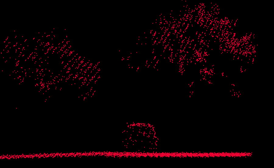
By filtering out the “noise,” or errors, in point cloud data, the most accurate deliverable can be created. This is particularly useful in mining and construction applications where accuracy is paramount to quick and confident decision-making.
The Precision Enhancement data processing module makes it easier to generate contour maps, perform volume calculations and update situation maps.
How Does Precision Enhancement Work?
mdInfinity’s Precision Enhancement module:
- Removes outliers and reduces the noise level of point clouds.
- Solves challenges related to outlier rejection and denoising in a unified environment.
- Enables users to isolate points belonging to relevant structures thanks to Microdrones density and morphology-based outlier reduction.
- Preserve edges and irregular features after denoising.
Precision Enhancement’s outlier detection sub-module is ideal when users have a dataset that contains points located very far from the point cloud, whether above or below, or points very close to the point cloud, but with unreliable or inconsistent positions.
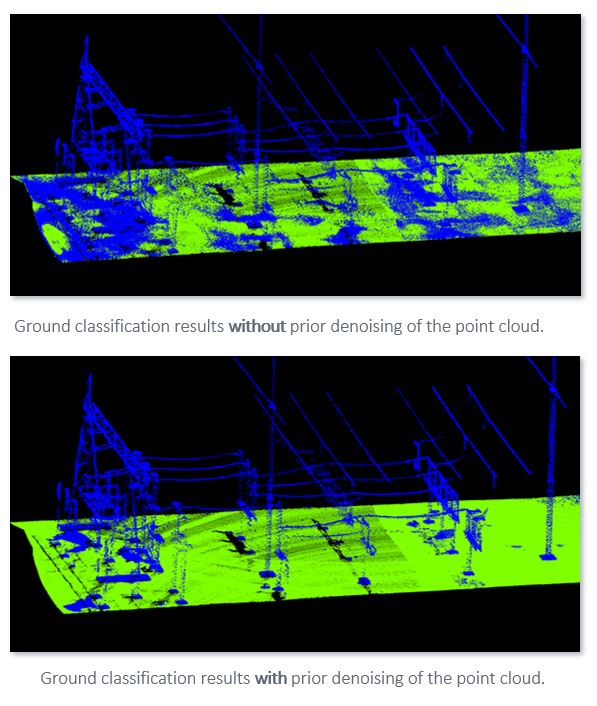
The denoising tool can be used to enhance the performances of classification tools, even for high grade LiDAR systems. Cleaning the flat surfaces found in the point cloud helps ground classification algorithms by reducing the impact of the noise in the identification procedure.
Why Is Precision Enhancement Important?
The name of the game is removing outliers without removing excess points that could be critical, such as sharp edges, vegetation and linear structure. This improves precision without causing key information to get lost in translation.
To put that improvement in perspective, a “regular” point cloud might have a thickness of between six and 10 centimeters. The mdInfinity Precision Enhancement module can achieve a thickness down to two or three centimeters. That’s a measurable result.
How Does Precision Enhancement Drive Tangible Results?
More than anything, Precision Enhancement drives critical efficiency, particularly in applications where both speed and accuracy are key.
It makes contour line analyzation clearer, and, overall, more precise representations of terrain lead to more realistic recreations of points of interest.
To learn more about using the Precision Enhancement Data Module in mdInfinity, CLICK HERE to speak with a representative from Microdrones.