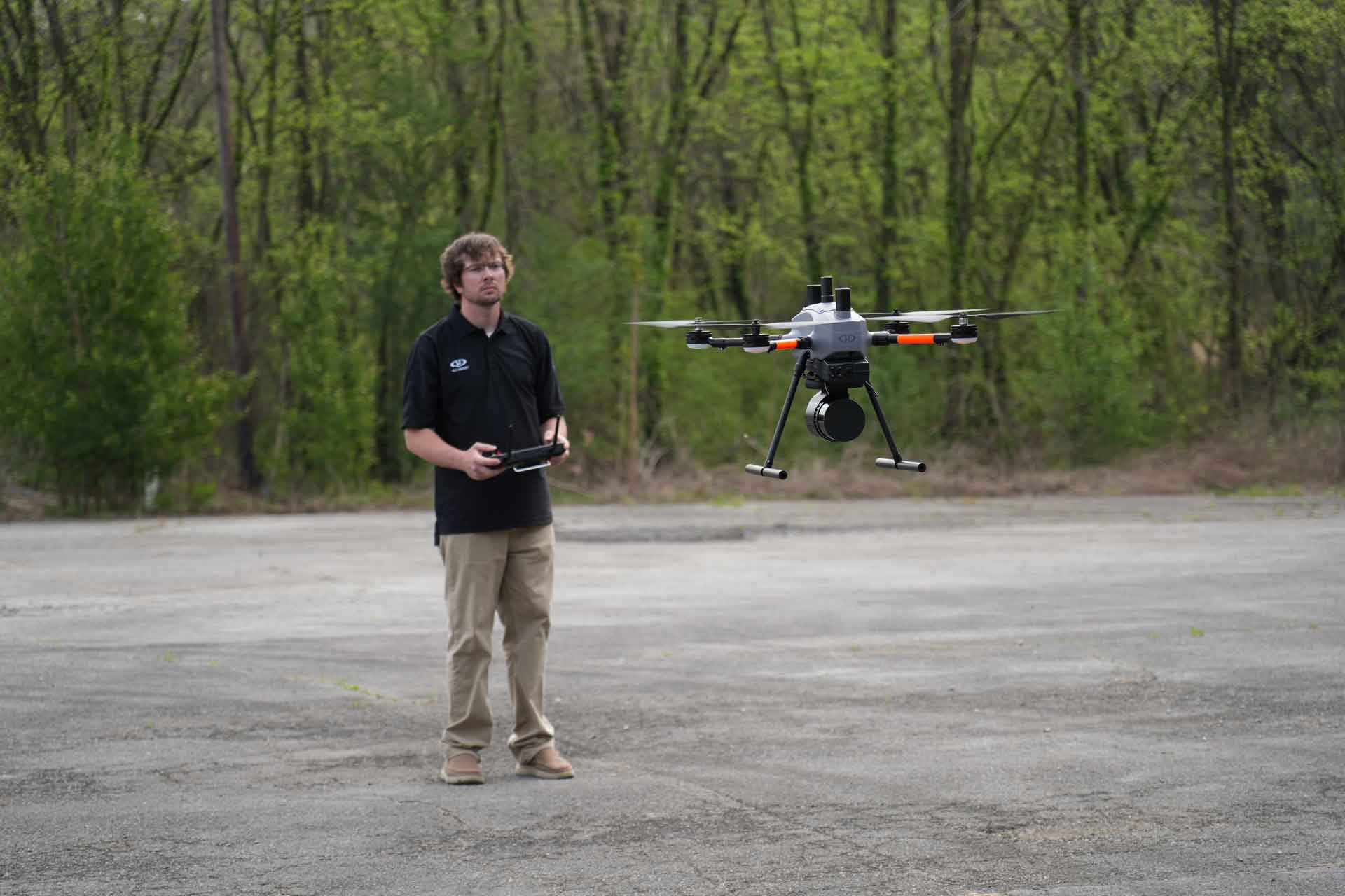
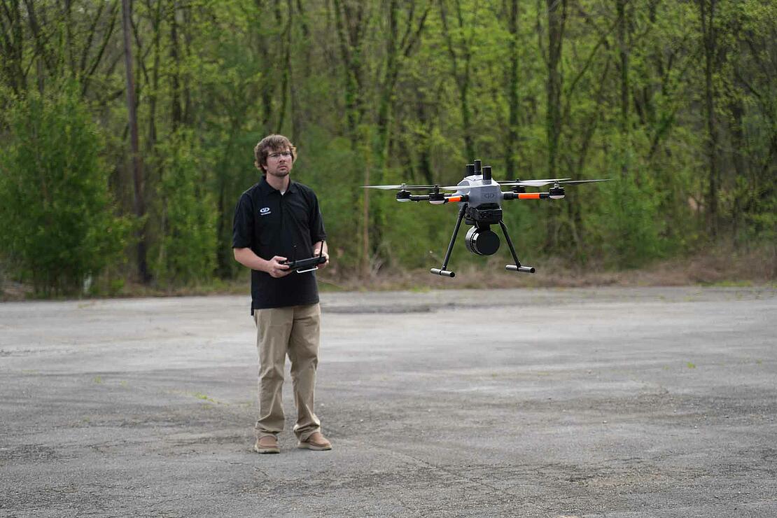
Experience unmatched portability, functionality, and reliability with the all-new EasyOne drone surveying system from Microdrones- designed to meet your needs and make your job easier.
Microdrones is committed to providing the ultimate in fully integrated drone surveying equipment. With customer feedback in mind, the company has unveiled its latest innovation in drone surveying technology: the all-new EasyOne, the most compact drone LiDAR surveying system on the market. This drone platform has been created to be a better, more efficient, and more practical solution to make your job easier.
In the video below, hear what people are saying about the all-new EasyOne from Microdrones, a compact and highly efficient drone surveying system that's been built based on feedback from customers. With EasyOne, you'll find a smaller operational form factor that's easy to transport and store and an entirely new Remote Control design that provides an enhanced user interface with mdCockpit. With full integration from mission planning through generating powerful deliverables in LP360 software, discover why EasyOne is the best LIDAR surveying drone ever built by Microdrones.
Meet the EasyOne
Chuck Snow, the eastern US sales manager anticipates high demand for this new drone LiDAR system. “The new EasyOne surveying drone is going to be a paradigm shift in drone surveying technology,” he said. “I think the marketplace is going to respond very, very well to what we've done.”
With EasyOne, Microdrones has reduced the operational form factor of the drone significantly while still maintaining the same payload capacity as their well-established md4-1000 platform. In addition to this, EasyOne is incredibly easy to transport, thanks to its compact design. A protective storage case comes with the system that is small and light enough to take anywhere, meaning you no longer need a large vehicle for transportation.
Miles Kelly, the new business development manager for Microdrones, will be focused on growing the market. “The EasyOne really excites me because of its portability and its small form factor,” Kelly points out. “Nothing can compare to being able to have a fully integrated system, especially a LIDAR solution that you can easily pack up and take with you into the field.”
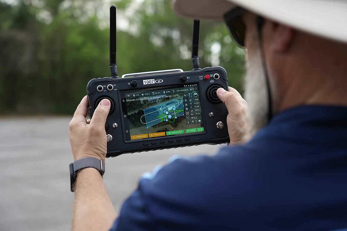
Customers also expressed the need for an improved RC controller and mdCockpit interface, which EasyOne provides. The new controller design offers an enhanced user interface combined with an integrated remote control that features the Microdrones proprietary mdCockpit application. The improved RC also includes increased bandwidth, which can enable live feed data, such as live FPV, to be transmitted with ease.
“This is going to be easily adoptable for any customers who have already used systems from Microdrones,” explains Brady Reisch, the Virtual Design and Construction Reality Capture specialist from Kuker-Ranken. “EasyOne utilizes the same mdCockpit application that was used on a tablet and now is fully integrated into a new remote control. So, instead of having a tablet as your screen and a separate controller for the drone, it's now one and the same.”
Easy Features
To help achieve the highest quality of data collection on the market, EasyOne features Real Time Terrain Following, enabling the drone LiDAR system to follow the terrain in real-time. According to Reisch, this feature will benefit all mapping customers. “That means the system is actually live scanning the ground with the LIDAR and evaluating the distance to the UAV. This keeps the drone equidistant to the ground, providing more accurate LiDAR data.”
When it comes to powering EasyOne, a new battery management system enables easy charging via a single connector. You can simply plug it in, and the charging process starts automatically. Easily monitor the charge via LEDs on the battery throughout operation and charging. The system also features a quicker payload connection, making setup much more efficient.
Mark Forsyth, the NEI Sales Director for Drone Services, is impressed with the improvements.
He adds, “The EasyOne quick-connect system streamlines the process to connect the payload to the drone. This new system removes all the connection wires allowing for a much smoother transition from taking the drone out of the box and connecting the payload to the drone itself. Within minutes, you’ll be ready to fly and scan your project.”
Responsible Sourcing
Microdrones has continued its commitment to responsible sourcing with EasyOne. The drone is designed and assembled in Germany, and all the onboard electronics, except for the motor controllers, motors, and batteries, are made in Germany. The technology, firmware, software, and workflow, developed and refined by Microdrones since 2006, are all used with the new platform.
The new EasyOne system will be available in three fully integrated LiDAR solutions: the EasyOneLiDARUHR+, EasyOneLiDARUHR, and EasyOneLiDARUHR Lite. Kelly understands the need to provide users with a survey-grade system best suited to their needs. “For the UHR+ and the UHR/UHR lite, the ability to be able to generate a colorized point cloud from those payloads is very incredible,” he explains. “Especially considering it's now delivered in a smaller form factor and smaller overall package. These LiDAR systems have absolutely been proven in the field and I believe moving forward these are great alternatives to any other solutions in the market.”
Order today
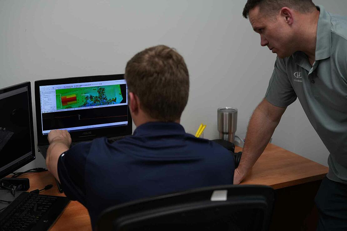
The EasyOne drone surveying equipment features unmatched benefits, such as smaller size and ease of use. The quick-connect payload is more efficient for set-up, and the real-time terrain follow and collision avoidance ensure the drone's safety. With full integration from mission planning in mdCockpit to generating powerful deliverables in LP360 software, the complete workflow simplifies the user's workload making it incredibly easy to plan, fly, process, and visualize your geospatial data projects.
“Ever since I heard about EasyOne I've been incredibly excited because we're going to have something nobody else has,” said Snow. “It makes it so nice to be able to take a little drone out and put it up in the sky and fly and complete your mission. It just makes it easier- that's why we call it EasyOne. This new system is much easier, more reliable, and it just works great.”
If you’re considering drone LiDAR surveying equipment and software, be sure to check out the new EasyOne from Microdrones. Schedule a time to speak with one of our representatives today.