PLAN, FLY, PROCESS & VISUALIZE
Watch these videos to see how Flick Ingenieurgemeinschaft is using drone surveying equipment and software to streamline ITS business.
PLAN AND FLY
In the first video below, watch how Flick Ingenieurgemeinschaft deploys the mdLiDAR1000LR to survey a large mining/construction site.
The team at Flick Ingenieurgemeinschaft needed to survey a large and challenging mining/construction site, to check the current volume of the excavation, measure boundaries and recalculate total levels. Niels Flick, the UAV Pilot for Flick Engineering, put the mdLiDAR1000LR to work, to collect the necessary geospatial data and cover the entire project.
“Our collaboration with Microdrones started in 2019," Niels said. “We were searching for a solution that extended our current scanning technologies and we thought drone flights were very interesting for that.”
Samuel Flick, the Central European sales manager for Microdrones, joined Niels on the project. “One of the challenges on this project is that it’s a large area of eight to nine hectares,” Samuel explained. “There’s a very big difference in the size and the height. There’s also ground vegetation in between. So, I would say to map this whole area is an ambitious project.”
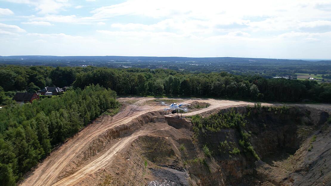
The mdLiDAR1000LR is well suited for this type of project. mdLiDAR1000LR means longer range with the ability to cover more ground from above. The system is also fully integrated with a 26 MP camera, so Flick Ingenieurgemeinschaft will be able to create an orthophoto in addition to a fully processed LiDAR point cloud.
“For me,” said Niels, “the most exciting part of this work is that I can fly a drone in the field and then come back in the office and do the data processing. It's also very exciting to inspire the employees. They also love to work with this data and that is very exciting for us.”
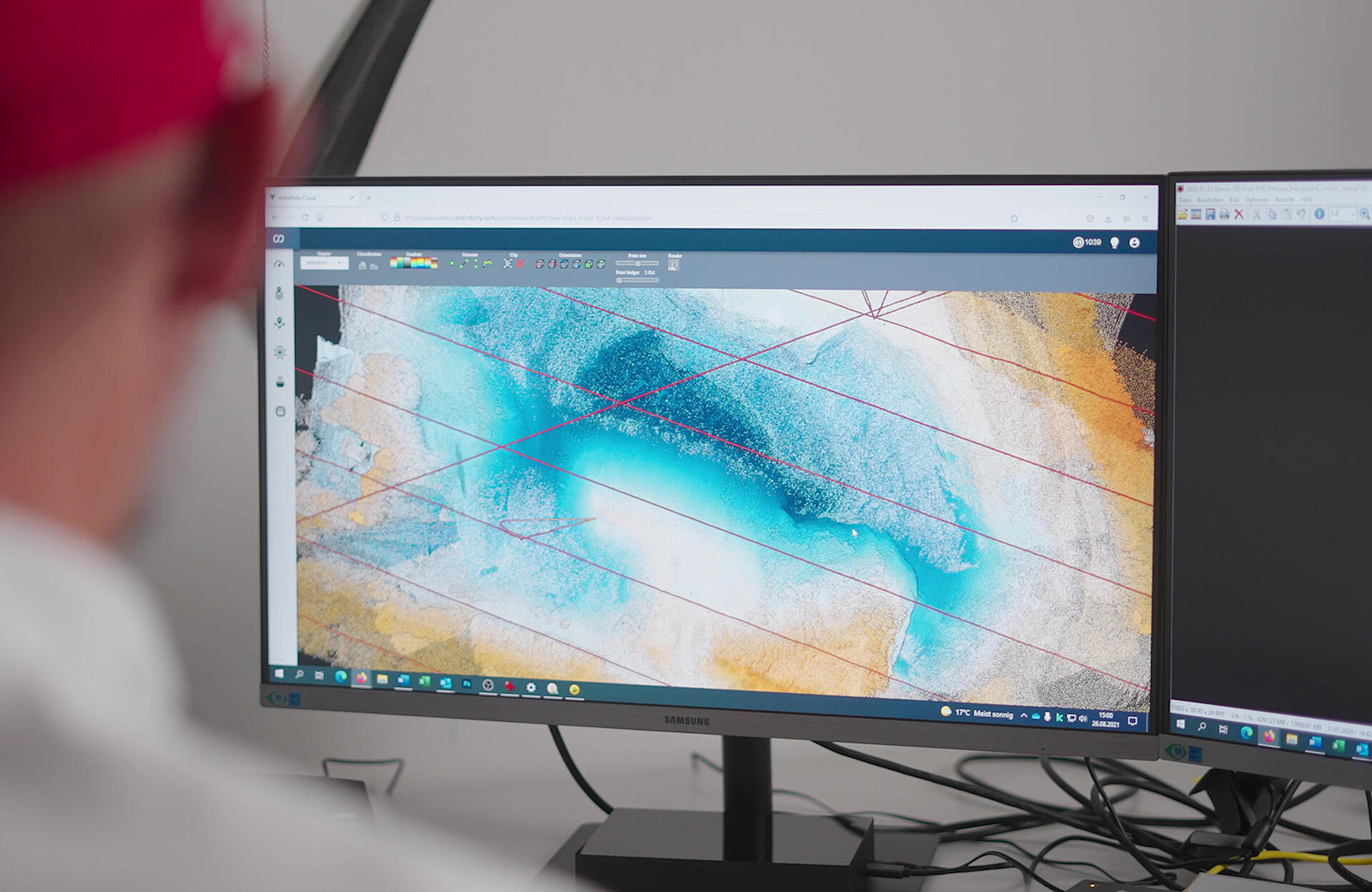
PROCESS & VISUALIZE
In the next video, Flick Ingenieurgemeinschaft processes their data using mdInfinity software, to create a LiDAR point cloud and an orthophoto of the project.
mdInfinity is a powerful data processing suite that allows the user to process geospatial data quickly and efficiently. This was a great benefit to Niels and his team. With mdInfinity, they were able to preview the pointcloud, trajectory, and colorize the elevation levels. Once the data was processed, it can be imported into another 3rd party surveying software to create the final deliverables.
Niels was able to compare excavation levels at the site from previous drone Lidar surveys and he was very happy with the results.
“The desired outcome on this project was a point cloud and an orthphoto and we managed to get both in a very high quality,” said Niels. “For me the results were very good and it was a successful mission.”
If you’re interested in learning how to adding drone surveying into your workflow, talk with one of our friendly sales representatives to see how you can start collecting data efficiently and safely while cutting costs, saving time, and converting data into useful information.