Watch this informative presentation for an overview of the Microdrones EasyOne Drone LiDAR Systems
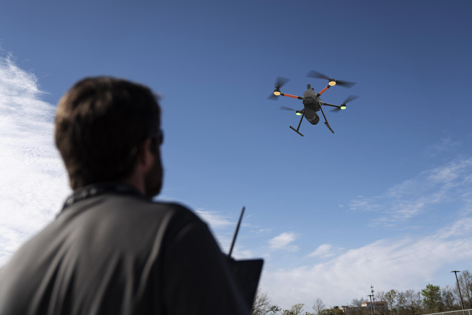
This is our best LiDAR drone surveying equipment ever. Built upon our 4th-gen drone technology, all EasyOne systems are more compact, more optimized, lighter, safer, and more efficient. This system delivers integration unmatched in the drone surveying industry, making it easier than ever for you to plan, fly, collect, process, and visualize your geospatial data projects.
EasyOneLiDARUHR+, EasyOneLiDARUHR, EasyOneLiDARUHR Lite and EasyOneLiDAR NDAA are fully integrated systems for producing 3D point clouds optimized for land surveying, construction, oil & gas, and mining applications. A fully integrated software workflow and world class support help users consistently provide quality deliverables. In the video below, Chuck Snow, the Southern US Sales Representative for Microdrones, provides a thorough overview of the EasyOne Drone LiDAR Systems.
Microdrones EasyOne Systems
Setting a new industry standard, the EasyOne drone LiDAR system outshines competitors by delivering a compact size without compromising on carrying survey-grade LiDAR equipment. Its portability allows for easy transportation in small vehicles, easy maneuverability in the field, and seamless adaptability to your surveying and mapping projects. For your convenience, the presentation has been time indexed below:
0:00 Introduction
1:58 Microdrones EasyOne Systems
4:56 EasyOne UHR+ LiDAR Pricing
5:34 EasyOne UHR LiDAR Pricing
5:42 EasyOne UHR Lite LiDAR Pricing
5:56 EasyReplacement Program
6:57 EasyOne Unique Selling Points
8:06 EasyOne NDAA Overview
10:14 EasyOne NDAA Compliant Payload
12:00 EasyOne NDAA Pricing
12:37 EasyOne Overview
14:15 EasyOne UHR+ Specs
14:45 EasyOne UHR Specs
15:24 EasyOne UHR Lite Specs

EasyOne is an optimized and fully integrated drone system that will provide the lifting power to carry LiDAR and photogrammetry surveying equipment. It improves upon the company’s legacy drones in three key areas:
EasyOne is Easy to Use.
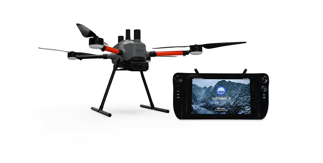
The EasyOne is a fully integrated drone LiDAR system that is an easy choice for geospatial professionals. The full package includes everything you need to begin aerial mapping including a drone, payload, RC, flight planning, post processing software, workflow, training, and support.
Snow explains, “I've had the privilege of working with a wide array of sensors over the years, processing data, and I'll be the first to admit, I'm not the smartest guy out there. However, when it comes to Lidar, things have become remarkably straightforward. EasyOne is designed for ease of use, streamlined operations, and extensive automation. We've heard what our customers want. We listened, we acted, and we produced the most compact Lidar solution available today, complete with all necessary components for drone surveying.”
EasyOne is Easier to Transport.
EasyOne features a significantly smaller operational form factor with the same payload capacity as the md4-1000 platform. In addition to a smaller operational form factor, the EasyOne packs down even smaller, fitting the drone, remote, charger, two batteries, and the payload into a protective storage case that’s small and light enough to bring anywhere.
EasyOne has an Improved RC Controller and mdCockpit Interface.
EasyOne has an entirely new controller design that provides an enhanced user interface and safety features. Now, the RC and tablet are one integrated control unit, making it even easier to plan and fly projects. Furthermore, the new controller design provides an enhanced user interface and powerful safety features, such as Real Time Terrain Follow. It’s easier than ever to plan, monitor, adjust, analyze, and control your projects right from your controller.
EasyOne NDAA
Now available is a special NDAA-Compliant version of the EasyOne, designed and assembled in the USA and Germany. This means that all onboard electronics except for motor controllers, motors and batteries are made in Germany. Microdrones technology, firmware, software, and workflow developed and refined since 2006 provides the brains of this powerful new system.
The EasyOneLiDAR NDAA features a new LiDAR sensor with 128 channels and Triple 1’’ cameras with mechanical shutters, providing RGB 60 MP combined resolution. It’s the first complete solution of its kind to hit the market with NDAA-compliance.
In the ever-changing airspace of geospatial mapping technology, the EasyOne Drone LiDAR Systems from Microdrones set new standards that are hard to beat. Featuring compactness, ease of use, and outstanding portability, this innovative system is a game-changer for professionals in the field. As seen in the presentation from Chuck Snow, it's a leap forward in simplicity and automation. The improved RC controller and mdCockpit interface make planning and executing projects much easier, all while ensuring safety. With its cutting-edge features, this system delivers the most compact, efficient LiDAR solution on the market today along with an NDAA compliant version. Microdrones makes it easier than ever for professionals to excel in their geospatial projects with the new EasyOne drone LiDAR systems.
For more information on getting started with drone surveying, schedule a meeting with one of our expert representatives.