using drone-based lidar to improve workflows, collect better data, and increase efficiency and profitability
as seen in Novus Light Technologies Today
by Matt Rosenbalm
Professionals who work in construction, engineering, surveying, or land development have probably either experienced or considered the awesome power of drone-based lidar to improve workflows. As technology transforms these industries, professionals are able to collect better data in a fraction of the time.
But it’s not just the ease of use and sensor capabilities that make a difference for experts who use UAV integrated systems. Users also benefit from vastly improved data processing and visualization.
This added layer of time-savings, within the context of a project that has already been streamlined by drone-based lidar, amounts to impressive efficiency and profitability. By improving every step of the process, companies that use integrated unmanned aerial solutions are able to complete more projects, more quickly.
Lidar in action
Microdrones, is a provider of integrated unmanned aerial solutions. The company offers UAV lidar and photogrammetry based mapping, surveying and inspection packages, such as the mdLiDAR3000, that allow companies to collect data efficiently and safely while cutting costs, saving time, and converting data into useful information.
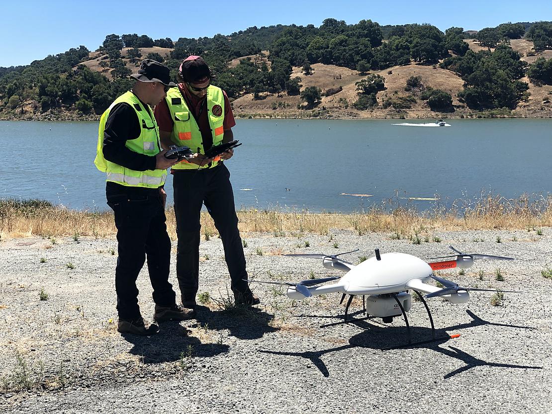
The Microdrones team recently performed such a comparison with a surveying group in Southern California. The group planned to send a team of six people to survey a highly vegetated job site by hand for two weeks.
Using the mdLiDAR3000, the group was able to collect this data in a single 13-minute flight. Microdrones flew this flight at 50 meters altitude, with 50% overlap between flight lines, at a speed of three meters per second. Rather than having six people on site for two weeks walking with GPS and staking it out, a team of two can send a drone into the air, cover the area in a day, maybe add a second day for post-processing, and end up with similar — if not better — data than the team would collect using traditional methods.
All of this is accomplished with one solution from Microdrones that combines the heavy-lifting md4-3000 drone with a Riegl lidar sensor and a Sony camera. The mdLiDAR3000 also includes flight planning and data processing software. Together, these components make it easy and quick to produce colorized point clouds.
Users also appreciate that this system eliminates the frustration and time involved in dealing with on-site vegetation. Where they used to spend hours cutting line to topo the site, they no longer need to do that with our system.
Doubling down with data
Efficiency in data collection explains why drone-based lidar is becoming widespread for applications like corridor mapping, mining, contour mapping, construction site monitoring, and forestry — but it’s only part of the story. The last, and lesser known, step in revolutionizing these applications is streamlined data processing.
To understand the unique ways in which Microdrones slashes data processing time requires knowledge of direct georeferencing (DG) technology. DG integrates an advanced GNSS receiver with an Applanix IMU paired directly with the payload. This helps to determine the exterior orientation without the need for aerial triangulation techniques necessary with 95% of the other drone-based solutions on the market.
Direct georeferencing enables corridor mapping. It also reduces or eliminates the need to go out and set up a bunch of ground control points on your site. That saves a lot of time. But another important distinction is that direct georeferencing reduces side lap and end lap. Because you're taking fewer photos, you’re collecting less data, which significantly reduces your post-processing time.
All of the collected and georeferenced data is stored on the drone during flight. A local base station, smart base, local network, or smart target with a dual-frequency receiver also gathers static data on the location during the flight.
After the drone lands, the user pulls three files from the drone: the raw lidar data, the direct georeferencing data, and the base station data. This information is imported into mdLiDAR processing software and to POSPac UAV, software from Applanix specifically developed for its DG technology.
Using these two software programs, the user can seamlessly process the data to create a georeferenced point cloud, a 15 to 20-minute process. It’s much quicker than photogrammetry to actually be able to start manipulating your point cloud using Trimble Business Center (TBC) or another visualization software.
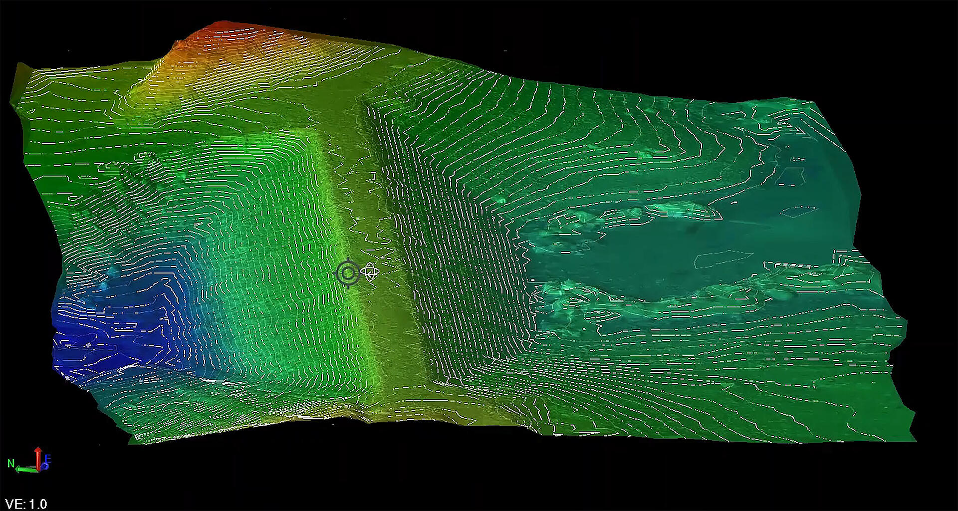
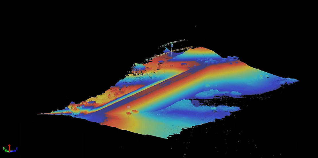
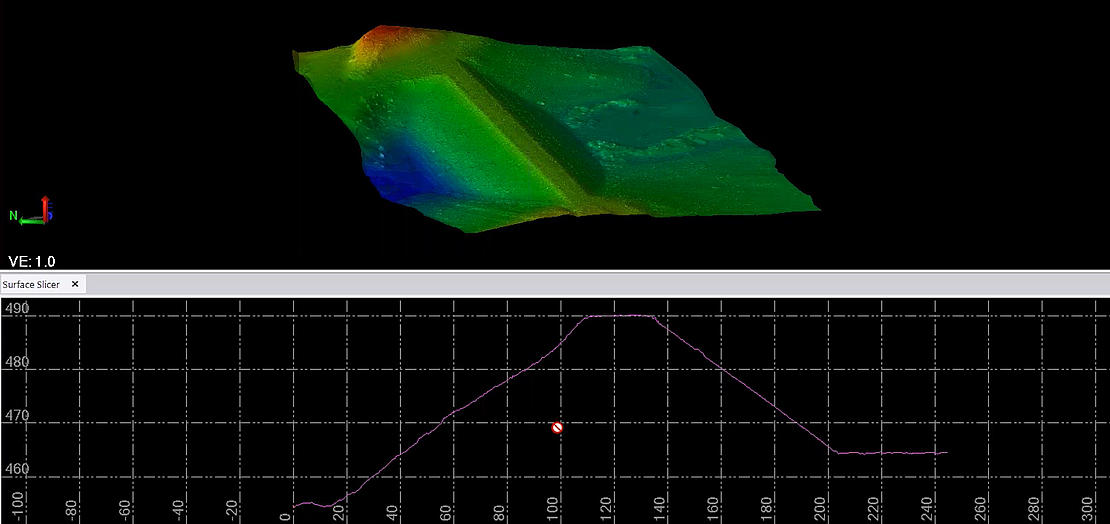
Using TBC, users can then make adjustments to their imagery, such as creating contour models, removing vegetation, and sampling out points for a cleaner dataset.
Getting to this point, from actually grabbing the data off the drone to producing a digital surface model, is a simple process that can take the user between 30 minutes to an hour. They’re able to go from field to finished product in 24 hours, versus waiting weeks to get the data back and actually starting to produce their deliverables. This is extremely valuable for users.
In addition to the Riegl sensor on the mdLiDAR3000 system, a Sony RX1R II 42-megapixel camera is also included. This allows users to simultaneously complete the necessary lidar data collection, generation of the point cloud, and any photogrammetry components of their project.
Users can create georeferenced orthomosaics or larger pictures, if needed. Then two flights aren't necessary to create both. Our hardware and software engineers have done everything they can to make data processing quick and easy for our users. This is one of the benefits that help our systems pay for themselves.
If you would like to learn more about processing data with drone-based LiDAR, CLICK HERE to speak with one of our friendly representatives