Propelling: Drone Surveying Use in Mexico
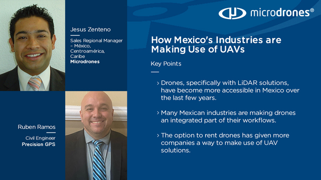
with Jesus Zenteno and Ruben Ramos

How drones are becoming more accessible to many industries in Mexico
Jesus Zenteno, Microdrones Sales Manager for Latin America, sees the signs that indicate the use of drone surveying equipment in Mexico will be very common for companies in the near future.
“We’ve started to see businesses, in the private sector as well as the public sector, make their first efforts,” Zenteno said. “They’re beginning to develop internal departments where they’re starting to make investment in drone surveying equipment, like the mdLiDAR1000 aaS.
With companies like Microdrones, that make the price of technology more accessible, Ruben Ramos, UAS manager for Precision GPS, says that now not only can companies get information but they also can get better information they can use to cut spending.
“The cost to enter the drone surveying market is not even a tenth of what this technology cost before,” Ramos said. “Before, you paid thousands and thousands of dollars and you just go the information. Now, for that same amount, we can have technology and software that generates much more precise information than before.”
While other markets around the world may be more advanced than Mexico when it comes to UAVs, there is no doubt it’s an area of growth in the country. Listen to more about the use of drone surveying equipment in Mexico in this episode of Propelling or read the summary below.
When it comes to drone surveying, what’s true in Europe, the United States and many other parts of the world is true in Mexico, according a pair of industry professionals.
“Drone surveying equipment is here to stay,” said Jesus Zenteno, Microdrones sales manager for the Latin American region, during a recent episode of the Microdrones podcast Propelling.
Zenteno and Ruben Ramos, UAS manager for Precision GPS, told Propelling host Daniel Litwin the opportunities for Unmanned Aerial Vehicle (UAV) usage in Mexico are plentiful and the need for drones in many Mexican industries has grown.
“It’s become a revolution in our industry,” Zenteno said. “Drones are an essential tool in topography, in medical inspection, several things. And it is mainly affecting engineering.”
Mexico’s use of drone technology has kept pace and perhaps even outpaced its Latin American neighbors, Zenteno said. Currently, the number of inquiries he receives from Mexican clients more than doubles the number he receives from Central American and Caribbean clients.
Over the span of eight years, Ramos has seen use of drone technology in the surveying industry go from a crowd-drawing event to a very routine part of any job. Even more impressive, Ramos said, is the accuracy of the data collected.
Drone Surveying Applications in Mexico
From topography to construction, mining to agriculture, city planning to environmental studies, if the particular field requires surveying, it is seeing a boom in drone use in Mexico, Zenteno said.
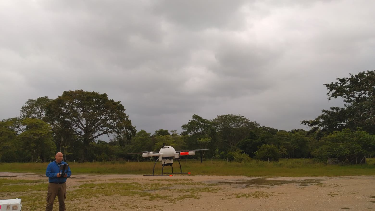
In mining, this means safety, as surveyors don’t have to go physically into unsafe areas to take pictures, Ramos said. Drone surveying equipment, like the mdLiDAR1000, allow the Mexican mining industry to track volumes and performance, and correct mistakes and inefficiencies in the moment, and provide daily reports to mine investors.
In construction, Ramos said, no longer is it necessary to send crews six months in advance to travel an entire road with cameras. Simply send a crew with an mdMapper1000DG aaS and you have very fast, very precise data and photographs with evidence.
The Mexican agriculture industry uses drones to check crops and ensure insecticide is not being wasted, he said. And Mexican local and national land registers seek drone solutions to detect problems, which saves the Mexican tax payer money.
No longer is it a question of whether Mexican industries will use drones, Zenteno said. Many are taking the next step by using LiDAR technology instead of traditional photogrammetry to receive the absolute highest-quality data. LiDAR gives you a digital deliverable ready to process by most existing software on the market. In Mexico, tools such as the mdLiDAR product line form Microdrones have gone from being a luxury to a necessity, Ramos said.
An Easier Way to Fly
While some large, Mexican companies have departments dedicated to drone usage, both Zenteno and Ramos said, due to regulations governing the use of drones, the practice is not widespread in Mexico. Many Mexican companies still prefer to utilize outside companies dedicated to drone surveying. This allows them to enjoy the technology without having to purchase the drones, maintain them and obtain permits.
Services like Microdrones as a Service, allows an entity to rent the drone equipment and pay per project for the software usage. It also puts cutting-edge solutions with LiDAR technology in the grasp of small and midsized companies, Zenteno said. The rental option, Ramos added, comes with Microdrones expertise and superior customer service.
And while the purchase of a drone is still a major investment, it is not a tenth of what this technology cost previously, Ramos said. Mexican surveyors no longer need to seek help from Canada or the United States to do a LiDAR lift, he said.
Finding the Right Distributor
Microdrones looks for companies with drone surveying experience to be its distributors in Mexico, Zenteno said, ones that have worked hand in hand with companies in the mines or in other projects. A Microdrones distributor must have the knowledge of Microdrones equipment, be able to provide training to the user and be able to guide the user through regulatory issues.
Precision GPS meets all those requirements, he said. Microdrones looks to duplicate the success it’s had with its Mexican distributor Precision GPS in the Latin American region.
“Before buying our solution, our user must understand what he is going to get, what are the benefits he is going to have, not to generate an overexpectation, but really that he is going to be comfortable with what he is going to buy,” Zenteno said. “Precision is a company that transmits the value of Microdrones, and is interested in not selling drones, not meeting quotas, but being able to deliver solutions to its customers.”
Ramos said Precision GPS has flourished due its customer service.
“We do this as a company, good technical support,” he said. “Someone who always answers the phone, someone who solves customers’ problems quickly, someone who has the factory close by. In case they have any questions I do not have to say, ‘Wait for France to answer, wait for Germany to answer.”
Expanding the Use of Drone Surveying Equipment
Ramos said Precision GPS performs training on Microdrones products in Mexico. This shortens the company’s clients’ learning curve. And while the COVID-19 pandemic altered an aggressive marketing plan this year that included site visitation, it has presented unexpected opportunities, he said.
The dawn of a remote work force forced companies to reinvent their work processes, and drones reduce the need for people in the field. Additionally, the work stoppage initially caused by the pandemic gave companies a chance to research technologies available to them, Zenteno said. The net result, he said, has been more, not less business.
“Exactly,” Ramos agreed. “We stopped the visits, but truly the requests grew.
“I was talking to people in the mining industy, where the operators were maintaining their surveys. While they didn’t take any risks, they kept working and using the LiDAR to collect their data and move forward. This particular mine has LiDAR, and they take care of it more than their car because it’s what makes their job easier.”
It's clear to Zenteno that the drone surveying market in Mexico will only grow as costs decrease. Companies that do not utilize drone technology, and more specifically LiDAR technology, for their surveying needs will find themselves left behind.
“The market is far from saturated and we are still at the introductory stage in the use of drones in the country’s industry,” Zenteno said. “There are already many success stories that are really putting the professional drones in place and that is only going to continue.”