Using the GE industrial drone line to survey power lines with LiDAR
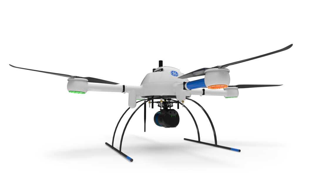
The mdLiDAR1000LR is the newest member of the GE industrial drone line of Lidar survey equipment offered by Microdrones. The mdLiDAR1000LR uses the lifting power, resilience, and efficiency of the Microdrones aircraft platform to carry a perfectly integrated Velodyne Ultra-PUCK VLP-32 LiDAR sensor for longer range coverage and the ability to deliver high-resolution point clouds. In addition, for augmented photogrammetry, the system is also combined with a Microdrones CMOS APS-C 26MP camera.
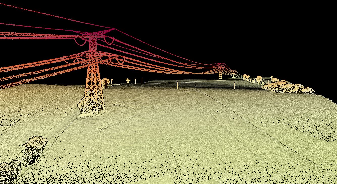
To demonstrate the ability to cover more ground and deliver high-resolution point clouds that can be created from data collected by the mdLiDAR1000LR, Microdrones has created a sample point cloud of power lines for review. CLICK HERE to open the viewer.
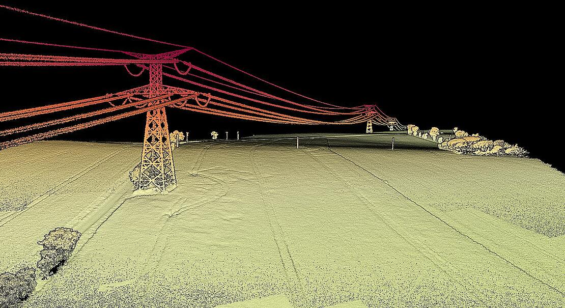
“The mdLiDAR1000LR increases the distance from which details can be captured,” explains Frank Darmayan, Chief Operations Officer at Microdrones. “It can capture powerline details at 75m for distribution and 90m for transmission, effectively doubling the range of our mdLiDAR1000HR system. Flying at 70m from the powerlines, at 8m/s allows for efficient location of the powerlines with roughly 10 points per linear meter and capturing great detail of the towers. The mdLiDAR1000LR is also a great tool for scanning large mines and measuring stockpile volumes. Flying at 100m AGL with 20% sidelap, the LR can cover over 1.2 square kilometers in a 30 minute flight, capturing a point density of 150 points per square meter.”
The Workflow
This project was conducted using the Microdrones workflow of Plan, Fly, Process and Visualize. Mission and flight preparation details, as well as the flight parameters and data acquisition will be reviewed for each flight.
Plan & Fly
Flight planning begins in mdCockpit and is then verified in the field upon closer inspection of the project. When flight planning is complete, the mission can then begin and the user can choose to autonomously fly the project.
The data was collected in 4 flights of the mdLiDAR1000LR, using terrain follow and flying at a constant flight altitude of 100 meters AGL at a speed of 4 meters per second. The terrain following functionality helps the user to safely plan a fixed elevation flight according to the data from a selected data source. The duration of each flight was approximately 20 minutes with 75% LiDAR sidelap and a field of view of 90°.
Upon completion of the flight, mdInfinity trajectory quality control was used in the field to confirm the validity of the trajectory data. This module exports a simple detailed report including the Mission Duration, the Number of Events, IMU continuity check or Base Station information amongst other information and details.
Also, while in the field, the LiDAR coverage preview module from mdInfinity was used to perform the validation of the point cloud datasets. The LiDAR Coverage Preview quickly generates a decimated point cloud for a fast baseline to validate the quality. However, it’s not a fully Geocoded Point Cloud.
Process & Visualize
mdLiDAR1000LR means longer range with the ability cover more ground from above, ideal for surveying power lines. The point cloud represents a section of transmission power lines in France. This location was chosen to showcase the ability of the mdLiDAR1000LR to adequately cover more ground while still providing high-resolution ground classification and high point density of the data.
The point cloud was created and processed through the mdInfinity software suite using DG Trajectory Processing, Geocoding, Precision Enhancement and Ground Classification. Using these mdInfinity data processing modules, vegetation has been removed and the bare earth data can be further processed to develop digital terrain models.
The Main Advantages
The mdLiDAR1000LR provides the ability to collect high density data based on the 32 channels that combines long range performance with outstanding resolution and point density. This drone LiDAR system also provides a higher level of detail and better canopy penetration thanks to the large 90° horizontal LiDAR field of view. Due to this classification routines can be performed with better precision than with point clouds with a lower density.
Data processing modules applied in mdInfinity create a unique layer per layer calibration process to enhance point cloud precision along with the ability to filter LiDAR data for point cloud quality enhancement resulting in best-in-class point cloud accuracy and precision.
If you would like to use the mdLiDAR1000LR to start collecting your own data, speak with one of our professional representatives.