NOW AVAILABLE ON
YOUTUBE AND MDTV
DOWN TO EARTH PROJECT 12: LIDAR FOR THE COURSE
Down to Earth, a surveying reality series shows how real surveyors collect data and turn it into real deliverables, despite challenging conditions, rugged terrain and lurking dangers.
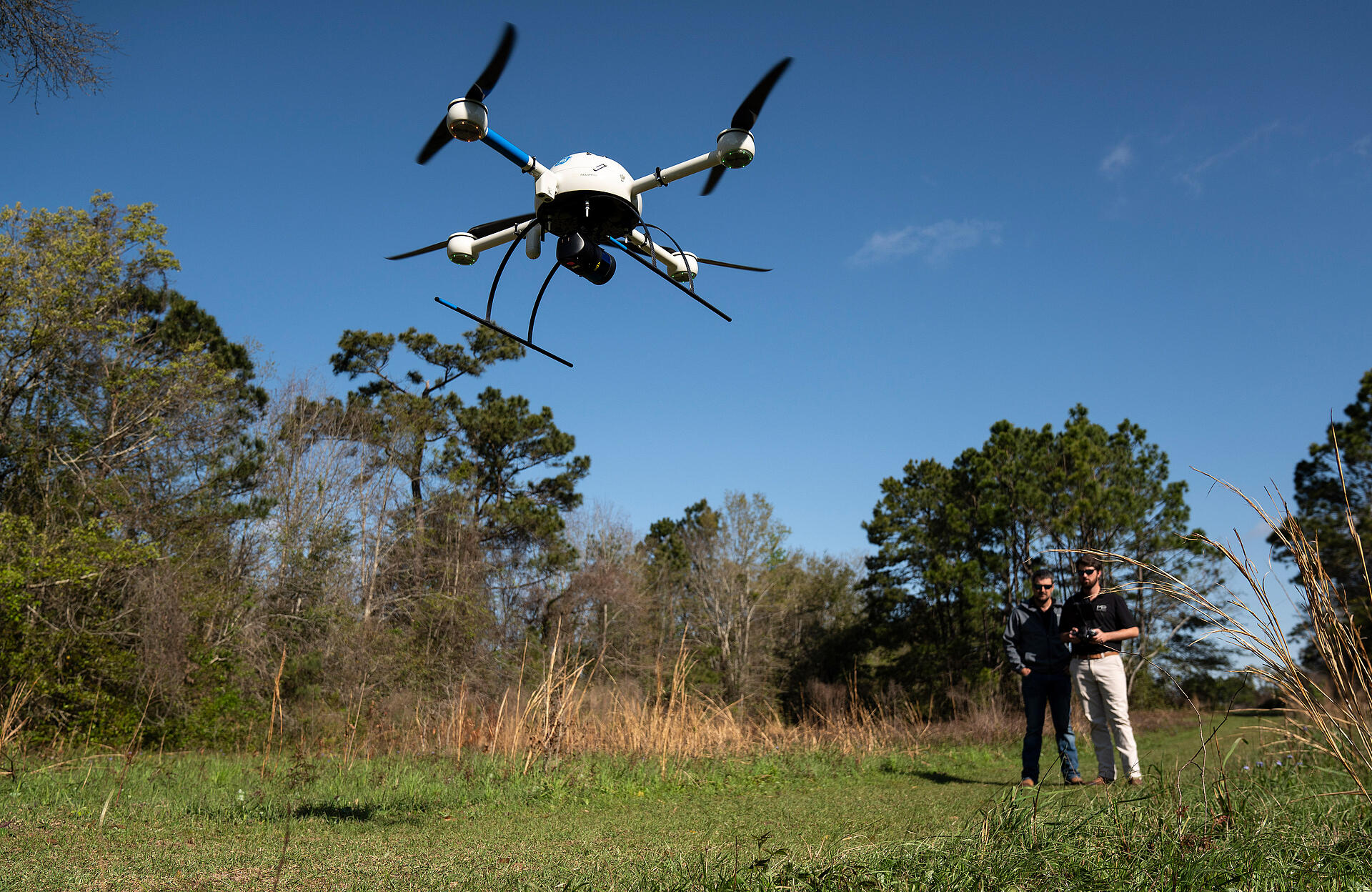
The greens are overgrown, the fairways are now part of the rough, and the tee boxes are extinct at an abandoned golf course in Biloxi, Mississippi. That’s why the team at MP Design Group was hired to create a feasibility study for residential development. To do this, they’ll use drone LiDAR technology to more efficiently create a topographic survey of the old golf course.
However, bad weather is on the horizon and they also have to contend with Class D airspace due to the proximity of Keesler Air Force Base. See how they deal with these challenges and more in new episodes of Down to Earth: LiDAR for the Course.
Watch Episode 1 Below:
In this 1st episode, Greg Thompson, PS, the VP of Field Services at MP Design Group, puts together the plan to scan the abandoned golf course with the construction inspector and drone pilot, Ryeley Jacobs. According to Thompson, “the mdLiDAR1000LR gives us the capabilities to penetrate tree canopies and wooded areas to collect more data for our ground topo and provide a better design surface for the engineers. We’re also able to provide the data much faster manner to our clients, allowing us to complete more jobs.
Completing more jobs is key to growing the business, as David Machado, the owner of MP Design Group, knows all too well. “The big difference between the LiDAR technology and conventional surveying is the time and manpower,” explains Machado. “It’s just totally changed the approach we’ve used in competing on surveying. It’s also changed the timeframe significantly reducing the turnaround times that we can give to our clients and provide them with the critical data that they are looking for.”
Watch Episode 2 Below:
In the 2nd episode, Greg and Ryeley tee the drone up at the abandoned golf course and try to get the project completed in one days’ time, to afford them the opportunity to work on another project the following day. Jacobs is confident that the Microdrones technology will help them get both jobs completed much faster than conventional surveying methods. “The main thing with the Microdrones products is the time spent on these jobs. Time and budget are the most important things in this industry and the drone has helped tremendously.”
Watch Episode 3 Below:
In the third and final episode of LiDAR for the Course, once the field work is complete, Thompson reviews and processes the data collected from the mdLiDAR1000LR, to create the final deliverables for his customer. He uses mdInfinity processing software to transform the raw survey data into the files needed to create a 3D point cloud of the ground surface. “The mdLiDAR1000LR was able to provide us with almost 62 million points on this short 22 minute flight,” said Thompson. “So, we have more than enough data available to create the topographic survey needed.”
If you're interested in learning how to create topographic surveys more efficiently by using drone LiDAR, schedule a time to meet with one of our helpful sales representatives today.