Make Drone LiDAR Surveying Easy.
Microdrones has developed end-to-end LiDAR systems combining drones, LiDAR & photogrammetry payloads, a fully integrated software workflow, and world class support to consistently provide quality data deliverables.
LiDAR + drones + easy to use software = Extreme Geomatics Productivity
EasyOneLiDARUHR+, EasyOneLiDARUHR, EasyOneLiDARUHR Lite and EasyOneLiDAR NDAA are fully integrated systems for producing 3D point clouds optimized for land surveying, construction, oil & gas, and mining applications.
EasyOneLiDARUHR+
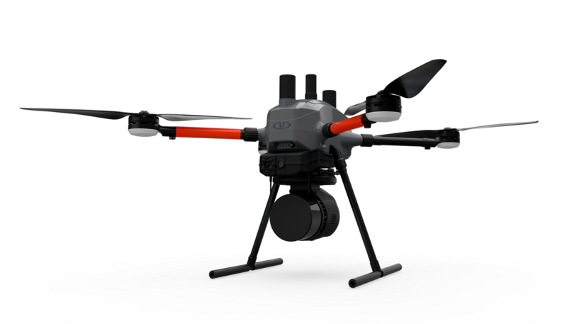
The Most Compact Survey-Grade Drone Lidar Surveying Equipment on the Market: EasyOneLiDARUHR+
This is our best LiDAR drone surveying equipment ever. Built upon our 4th-gen drone technology, all EasyOne systems are more compact, more optimized, lighter, safer and more efficient.
QUICK SPECS
- Platform
EasyOne
- System Accuracy
- LiDAR Pointcloud
- Typical 3 cm
- Photogrammetry
- Horizontal: 2 – 3 pixels
- Vertical: 3 – 5 pixels
- LiDAR Pointcloud
- LiDAR Sensor: Hesai Pandar M2X
- Camera Sensor: 1x Microdrones CMOS APS-C 26 MP
- Georeferencing: Trimble APX-15 UAV
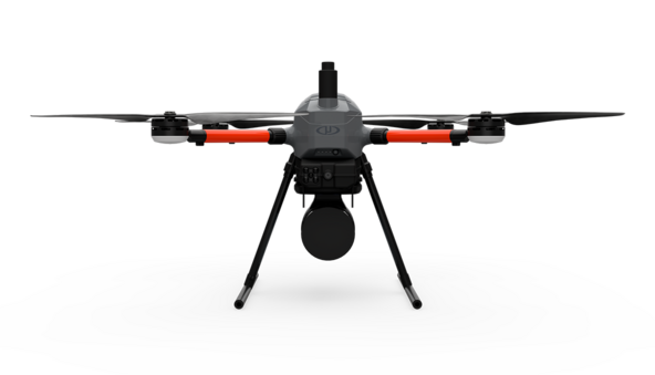
EasyOneLiDARUHR / EasyOneLiDARUHR Lite
Our Best Lidar Payload from the 1000 Series, Now Available on Our New Airframe: EasyOneLiDARUHR & UHR Lite
This system delivers integration unmatched in the drone surveying industry, making it easier than ever for you to plan, fly, collect, process and visualize your geospatial data projects.
QUICK SPECS
- Platform
EasyOne
- System Accuracy
- LiDAR Pointcloud
- 4 cm RMSE
- Photogrammetry
- Horizontal: 2 – 3 pixels
- Vertical: 3 – 5 pixels
- LiDAR Pointcloud
- LiDAR Sensor: Hesai Pandar XT-32
- Camera Sensor: 1x Microdrones CMOS APS-C 26 MP
- Georeferencing: Trimble APX-15 UAV
EasyOneLiDAR NDAA
Our NDAA-compliant options take our smart sourcing to an even greater level with NDAA-compliant, sensor payload, RC, data link and software.
QUICK SPECS
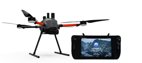
- Ground Control System
- RC with 8-inch integrated tablet (Samsung Galaxy Tab Active3)
- mdCockpit 2
- NO FPV camera
- Radio: 2x2 MIMO 2.4 GHz (Microhard)
- Tx power: up to 30dB
- Encryption: up to AES-256 (optional)
- Payloads available:
NEW NDAA compliant payload with- 3x 20Mpx cameras
- NEW Ouster OS1 LiDAR sensor (128 channels)