What Does the Future Hold When It Comes to UAVs and Industry?
Industries throughout the United States, and internationally, are beginning to utilize Unmanned Aerial Vehicles (UAVs) to streamline processes and maximize returns. Construction, specifically, is benefitting greatly from the adoption of UAV technology. The industry is expected to account for up to $11 billion in market potential by 2020, and the United States FAA has certified more than 66,000 remote pilots in the United States alone. Drones have given new life to traditional geospatial applications by providing worker safety benefits and more efficient ways of collecting data.
The Shift from Military to Commercial
Mike Hogan from Microdrones has an extensive background in unmanned aerial vehicles and geomatics. As a Geomatics Officer in the Royal Canadian Air Force, using drones to map for defense purposes helped form the basis his current work. Drones, prior to their commercialization, were once (and still are) essential to militaries. Using techniques and technology developed in the past, Microdrones has refined the technology to specifically help surveying, construction, mining and other industries in need of geomatics applications.
How Geomatics Enter the Equation
Companies seek safe and cost-effective solutions to deliver their data effectively and affordably. Geomatics, otherwise known as the art and science of collecting, processing, analyzing and distributing data to meet a specific need or requirement, is essential to the process of applying modern-day drones to mapping and surveying. For construction planning and management, geomatics plays a crucial role in the quality of results customers get from their drones.
“The geomatics are what’s really important. For success, the outcome is directly reliant on the people involved,” Mike explained in the recent Microdrones Propelling podcast. Microdrones is far more than a drone company—it is a solutions company providing the drone, sensors, workflow, software and training.
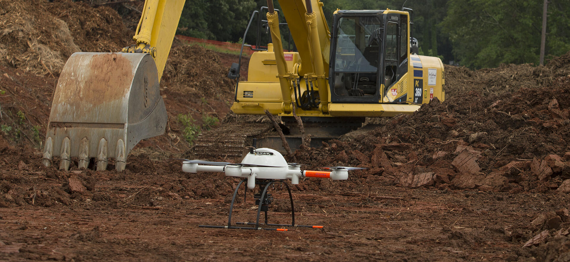
Drones Expand into New Industries
Insurance is a new, important industry utilizing drone technology. Historically, an insurance inspection would require the inspector to scale large buildings, risking serious injury. With UAV technology and perfectly integrated sensors, inspections can be done with as much detail and accuracy as a human without putting workers’ lives in danger. Integrated drone systems are also used to monitor buildings and gauge topography and soil type to create constant, easy-to-access data for any building planner or manager throughout the construction lifecycle. Check out this video to see how Brent Scarbrough & Company in Georgia are using a Microdrones mdMapper1000DG system 2-3 times per week on jobsites throughout the southern U.S.
Increasing Investment Drives UAV Application Innovation
In the United States, the value of drone activity rose from $40 million in 2012 to almost $1 billion in 2017. Beginning in 2016, The National Science Foundation (NSF) pledged to provide $35 million in research funding over a five year period to improve understanding of how we can use drones to better inspect infrastructure, respond to disasters, study severe weather, monitor agriculture, and more. The Microdrones platform is uniquely suited for the rigors of daily field use for professional applications.
Do you have a specific application in mind that a fully integrated drone system could make easier, safer or more efficient? Schedule some time to talk with us!