Work Smarter with Microdrones Drone Surveying Products
Here's How to Make Drones a Part of Your Surveying, Mapping, LiDAR and Inspection Work.
Want to create powerful data deliverables like 3D pointclouds or orthomosaics? Microdrones Integrated Systems help you to collect data efficiently and safely while cutting costs, saving time, and converting data into useful information.
We currently offer three families of solutions that will improve your workflow for LiDAR, photogrammetry and inspection projects.
Plan, fly, process and visualize. mdLiDAR solutions are fully integrated packages that provide professionals with the aircraft, payload, software and support needed to quickly and reliably generate pointcloud visualizations in the field.
EasyOneLiDARUHR+, EasyOneLiDARUHR, EasyOneLiDARUHR Lite and EasyOneLiDAR NDAA are fully integrated systems for producing 3D pointclouds optimized for land surveying, construction, oil & gas, and mining applications. A fully integrated software workflow and world class support help users consistently provide quality deliverables.
Software
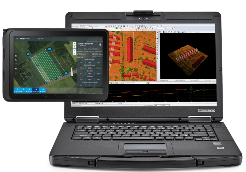
The mdCockpit software was designed to provide users with powerful tools that are easy to use. Available in versions for Android tablets and PCs, we highly recommend using our mdCockpit app.